A report about the parkrow study by Stephen Clark is available for download (Acrobat format)
This data is available for download by researchers. It should be noted that details of the licence plates have been altered to protect the privacy of the members of the public. This should have no effect on statistical analysis of the plates.
The format for the data is as follows:
The first column is the plate read. The next columns attempt to split the plate into registration year, digits and numbers. The final column indicates the time since the beginning of the survey. Some data has full plates, other data has partial plate (registration year and digits).
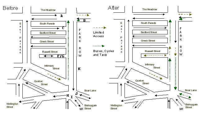
Before Survey 1
Location A
Before Survey 2
Location K
Before Survey 3
Location K(Survey 3 has two identical surveys on the same spot to check repeatability)
Matching code
This C code provides matching information on the above data files.Also available are pictures of our survey team hard at work and images of Park Row itself.
Home | Overview | Data Sources | The York Study | Theory | Publications | Contact
Information provided on 16/7/00 by Richard G. Clegg