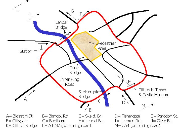
Note that locations K,L and M are off the scale of the main map and that locations E and M are split into two files (two lanes of traffic).
Note that locations K,L and M are off the scale of the main map and that
locations E and M are split into two files (two lanes of traffic).
The following data from the Lendal Bridge survey is available as zipped
text files:
All Lendal data chopped so survey starts at 8:00am and ends at 9:00am (note that on rare days the survey starts later or ends earlier due to technical problems - this will be obvious from the file)
Matching software c source code (tar'd and gzip'd) for programs to match plates between sites in various ways is included. It was written for unix but should work on any platform with a good C compiler. The "matchlots" program can be used to produce a matrix of matches between sites. The "convplate" program was used to check the original data for times and to interpolate 1 minute timings from the original 5 minute timings. The "matchplate" program does a simple match for two sites. Note that the numbers on these plates have been scrambled to preserve the privacy of York citizens.